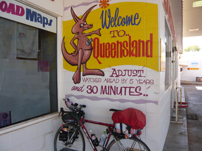
Start Pos. 31.958801 S 115.857580 E
Note! All positions are plus/minus 2 metres
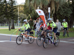
Day 1 The start was scheduled to March 29 at 8.00 am from The
Swann Bell Tower in Perth. Australian Red Cross had arranged police escorts
the first 18 km to Fremantle (Cool). A flock of local cyclists also followed me on the way,
and I therefore didn’t had to speculate on finding my
way out of the busy city.
In Fremantle after some 20 km we parted and I
was alone. Ahead of me were approximately 14,500 km of bicycling, and the idea
filled me with both excitement and anxiety. There is so much that can go wrong
and the trip should preferably be completed in less than 55 days and 16 hours.
Bicycling went fairly smoothly down the west coast and I visited Mandurra
town center as the rules prescribed, and took a "proof" photography
of the city center. There were 19 of these "benchmarks, and in order to
claim the prize of $ 15,000 I had to prove I had passed them all on my way.
Furthermore, I had to collect signatures from people along the way, who had
seen me on the road. This should be done at least 10 times, and with approximately
1500 km intervals.
The weather was fine with a fresh crosswind and the terrain was flat, so I was quickly
heading south. At one time, when a car passed from the rear, I felt a splash on
my back and learned that the driver apparently had not been able to eat up his chocolate
ice! So much for starting in a clean jersey!
I reached Busselton in the dusk after 234 km of
bicycling. Quite well, considering the fact that I had
started out late. The area was still relatively civilized, so I found a
caravan park to stay overnight in order to avoid any trouble with landlords :-).
234 km and 421 high & low. Pos. 33.654267 S 115.323236 E
Day 2 was harder with many
hills and headwind. I started out at 2 am as planned and as I expected to do for the rest
of the trip. I passed 2 fix points before sunrise at 7 am. The night was full
of kangaroo’s. They have a way of impulsively crossing the road when they (too
late) get frightened by me, so one have to be extremely aware during the night
and cannot safely cycle at full speed.
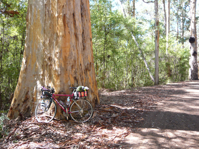
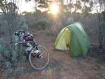
Karri trees
The rest of the day I biked through different types of landscape with both land
fields and forestry and ended the day after 286 km in the large Karri forests -
the home of some of Australia's largest trees. Here, I found a spot to put up
my tent out of sight from the road, as it is national park and probably not
entirely legal to camp here.
285.86 km and 2351 high & low. Pos. 34.703100 S 116.517261 E
Day 3 was less hilly but
offered a very strong headwind. I had still relatively strong legs and knew
that these kind of days are a part of the challenge, so it didn’t worry me too
much. Instead I was delighted that it didn't rain, as it had done on my two previous
trips in this corner of Australia.
At one point I discovered that a dog ran next to me. Apparently it just wanted company
and it was quite nice at first, but it soon became a pain though, because the dog began running in front of me, so I
had to brake all the time. After a while I speeded down a hill to get rid of it, and
succeeded, it was apparently completely gone. But around 1 km later, I heard
the characteristic sound of paws on the road next to me, and could welcome the
dog back again. Once more I speeded down a long hill, got rid of
it, and once more it popped up again. The third time I speeded down a
long hill I saw no more of it, but by then it had probably followed me around
10 km.
In mid-afternoon it began to rain. This, along with the wind, was a mixed
blessing, so I was happy to turn off the road into the Wellsteads
Roadhouse an hour later, very wet. They had no accommodation for the night, but
I was allowed to put up my tent under the roof of a picnic table. The rain and
the wind had now turned into a regular storm.
When I later lay in the tent
and had slept a half an hour or so, I discovered that I was lying in a 5 cm
deep puddle. Fortunately the tent bottom was waterproof, and I moved
on to another building where there was shelter and no puddle. Later during the
night, I was forced to move once more, because the wind tossed around with the
tent.
261.54 km and 1778 high & low. Pos. 34.493461 S 118.604556 E
Day 4 Because of the storm, I slept poorly and decided to
start biking again at 1 am. The wind had fortunately changed direction at night, meaning
there would be crosswind, but the rain and the wind was strong the rest of the
night. There were strong gusts most of the time and that was probably the
reason why water found its way into my GPS logger, although it was wrapped in several layers of
plastic. It resulted in problems with charging, and I also feared that it did
not log anymore. Another side effect was that my cycle pants became soaked because
my rain jacket was on the short side at the rear, and I therefore got a saddle-sore
that entertained me the next 11-12 days.
I arrived at Jerramungup close to daybreak, approximately
10 minutes before the roadhouse opened. Here was also 4-5 truckers waiting, and I
used the time to get a little order in my oddments, while I was monitored by the
truckers, sitting in their trucks. They probably wondered about the fool, who was out in this nasty weather.
Later in the shop, I could (while I made a puddle of water on the floor) wonder
about them and their appearance. Some of the trucker in Australia are really special
types; dirty and with tattered clothing.
The weather cleared up a bit
and there was even a little sun on occasions, so the rest of the day was
easier. Hilly on the first part, later it became more level. I arrived at Mungliup at the end of the day, where I put up the tent
next to an information board that had a little roof over it. It was still windy
and looked like the rain was not far away.
274.55 km and 1990 high & low. Pos. 33.704515 S 120.861080 E
Day 5 A good day with crosswind
the first 100 km. Then tailwind from Esperance to Norseman.
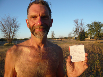
I had a man at Salmon Gum to sign my book, stating that he had seen me on the road bicycling,
so the first "statement" was made. I complained a little that many of
the new roads in Australia are so incredibly uneven, and that I preferred to
cycle on the old worn out roads. He could only agree, and said it was due to
savings from the government and that car and truck drivers are not satisfied with the roads
either.
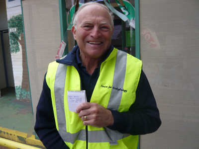
The man with his "Statement"
Approximately 10 km before I arrived at Norseman, the logger began flashing
red, which meant it had no more power. I checked in at a motel in Norseman and
after a bath and having filled the washing machine, I separated the device and
discovered that it was complety wet inside. I dried
the device with a towel and put it an airy place for the night hoping that it
would work again the next day. The logger was an extremely important part of my
equipment, as it logged a point for every 250 meters with place, time and
speed. It maintained information which would serve as proof after the trip, that
I had followed the demanded route.
312.66 km and 821 high & low. Pos. 32.187080 S 121.779060 E
Day 6 Started out in a starry
night at 2.52 am, in the hope that the next 1200 km across the Nullarbor plain would be with tail
wind. I tried to get the logger working again leaving Norseman, but it would
not charge. A few hours later I tried again and the miracle happened. The device
charged and seemed also to log, but I could not be sure, only hope. It appeared
after the trip that it had logged the entire trip perfectly, except for the
approximately 61 km at Norseman!
This night turned out to be the coldest
on the trip. The temperature decreases to 1 degree just before daybreak,
so I had to use all my clothes. With dawn came the wind, which unfortunately
was headwind, and I had to fight the rest of the day to reach the 270 km which
I was scheduled to go every day. Nullarbor is a
really bad place to have a headwind as it is mostly open landscape and flat. It was also hard on my knees, which began to ache because of the constant
pressure they were exposed to. There is no variation compared to more hilly
landscape. Camped in the bush.
273.44 km and 831 high & low. Pos. 32.395040 S 124.456650 E
Day 7, I started out at 1 am in
order to get more time to travel the required 270 km. Most of this night’s
biking was on the longest straight stretch in Australia; a 146 km road section that was completely
straight. I found it interesting that I saw the lights from a road train from far behind,
and that it didn’t pass me until 40 minutes later. The wind was still head on, so once
again it was a hard day. The knees got worse and my left knee got swollen up.
However, at the middle of the day it was as if the knees had given up the protest
and the pain decreased. Camped in the bush.
273.19 km and 330 high & low. Pos. 31.910680 S 127.209400 E
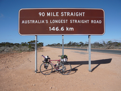
The straight road.
Day 8 The knees were in pain
at night and in the morning, so I had to take much account of them, but as the
day before it got better during the day. Headwind to Eucla, then crosswind for the rest of the day. Just
before the border to South Australia, there were 2 dead camels on the roadside
and to judge by "the smell" they had been there a long time. After
the border the road was better for cycling, it became smoother, but the shoulder
disappeared, so security was deteriorating. Camped in the
bush.
272.99 km and 181 high & low. Pos. 31.571578 S 130.011885 E
Day 9 Meet 2 dingoes in the
night and many rabbits. I reached the Nullarbor
Roadhouse at dawn and had to wait a bit before it opened. I was very hungry because
I had run completely out of food and ordered 2 servings breakfast.
The units are usually not so
great, but here they were, so I had plenty to eat! Headwind
the first 120 km, then crosswind. I had planned to reach Penong for the night because I knew they had a grocery store
where I could buy oatmeal and better food than the roadhouses provided.
I reached Penong in the very last light, but unfortunately after the store
had closed. However, there was a gas station where I could buy fast food (again), so I didn’t
starve. Found accommodation in the same caravan park where I stayed 2 years
ago. I tried to be witty, when I was asked about the type of accommodation I wanted.
The usual I replied, and got the desired response, a surprised detailed look at
me, at the end I guess it was only I who found it funny. Got the same cabin as
last time, and had a much needed bath.
310.44 km and 776 high & low. Pos. 31.925050 S 133.010110 E
Day 10 I reached Ceduna in the early morning. Here I had to decide whether I
should follow Eugens route or take the more accurate and
277 km longer route down to Port Lincoln. The decision, however, was not hard and already made
several days ago. I would take the longer route, because it followed the coast
and therefore were more in the spirit of the challenge. I felt I had done so well
so far, despite different kinds of trouble, that I could
allow myself the extra distance. I therefore turned right about 5 km
outside of Ceduna and pedaled south.
At one point I had an apple reached
out of the window of a pickup full of young people, thank you for that! I had
hoped to reach Ellidston, were I knew there was a
motel, but the light declined, and I chose to camp at the roadside, 20 km
before the city. I gathered I could not be sure of getting a room so late in
the day anyway.
284.98 km and 660 high & low. Pos. 33.442670 S 134.913335 E
Day 11 The night was filled
with grisly many kangaroos, and some rabbits, so it was exciting, but also extremly tiresom biking. That
night, I was overtaken by the many days with too little sleep, and found myself
rolling around on the road, almost unable to keep awake. I realized that I had
to spend time taking a powernap and sat down on the side of the road, where I immediately
fell asleep. Was awakened around a quarter of an hour later when a roadtrain rumbled by, ate a bowl of oatmeal and continued
while the morning broke. I had to take these powernap's, much against my will, every night on the rest of the trip, usually around 4-5 in the morning. Sometimes I didn't sleep, but mostly I got 10-20 minutes of sleep. Sometimes I woke up because I was falling down, sometimes because a roadtrain roared by, but every time I managed to get a little sleep I felt refreshed afterwards. The last 10-15 days I also had to powernap midday, usually under a bridge or anywhere I could get some shade
I reached and passed Port
Lincoln, and continued up along the east side of the peninsula Eyre and was given a
strong headwind. I realized soon that I would not get as far as expected that
day, and had to take a detour into Tumby bay to buy supplies for the rest of
the day and the comming night. Camped in the bush.
271.34 km and 993 high & low. Pos. 34.175605 S 136.247225 E
Day 12 I left my home in the
bush at 2 am and pulled the bike through the scrub. Suddenly I discovered that
my path was blocked of a large spider web with a spider in the middle. The
spider was a great chap at 7-8 cm in size, I didn’t know
whether it was one of the toxic ones, so I found another way out.
This day I had a hard
journey with a strong headwind and temperatures up to 34 degrees. Just after
having passed the town Whyalla I had my arms splashed
with some fluid from a passing pickup, which had an erratic course on the bumpy
road. First I thought it was water, but after a few hours the skin began to
bubble on both arms, so it had not been clean water after all. Perhaps some spray
liquid. The arms were to bubble up on the rest of the trip,
the burning sun probably didn’t help either! Here in the time of writing,
however, there are fortunately only the scars left.
I arrived in Port Augusta, pretty marked by the wind and sun, and checked in at
the first opportunity of accommodation in order to get in the shade as fast as
possible and have a cooling bath.
267.07 km and 807 high & low. Pos. 32.479515 S 137.753150 E
Day 13 The wind had not
changed direction overnight, which was quite good because from Port Augusta I was
now heading south and therefore had a good tailwind. I was now in a more busy
area and there was heavy traffic most of the way to Adelaide where I found myself
a motel.
299.29 km and 492 high & low. Pos. 34.850300 S 138.600491 E
Day 14 Started out at 2 am as
usual, and moved slowly through Adelaide’s relatively quiet streets. I made a pit
stop at a service station at the foot of the Adelaide hills, just to gather strength.
I remembered from earlier, that Adelaide hills is a very tough area, and the
road will wind up in the hills for the next 8-10 km. I reached the top at 576
metres above the sea.
Slight tailwind most of the day, and I hastened the pace to reach Kingston SE.
I was quite wet from the rain, and remembered that there was a motel in that
city, so would be nice to get there, and I did.
303.82 km and 1194 high & low. Pos. 36.824295 S 139.863178 E
Day 15 Quite hilly at the
Nelson area, I remember in particular that there were many Emus in that area.
Camped around 15 km east of Portland.
272.97 km and 909 high & low. Pos. 38.256778 S 141.704165 E
Day 16 The day brought me
past the Great Ocean Road and Lavers Hill, 468 meters above the sea, and a
lot of other hills. Approximately 20 km before the Great Ocean Road, I was
overtaken by 4 cyclists with a support car probably being out on a sundayride.
I passed them later when they had a rest at the Great Ocean Road. When I came
to the foot of Lavers Hill, their support car was waiting for them, so they
have not had much speed as they haden´t overtaked me.
Just at the foot of Lavers Hill and the next
2-3 km, there were roadworks and graveled road. The
road is very steep here, and because it rained, it was difficult to maintain
the momentum of the cycle when the rear wheel kept slipping on the greasy ground.
I arrived at the end of the day atWie River where I booked myself in on a
caravan cabbin.
275.96 km and 2013 high & low. Pos. 38.637100 S 143.887915 E
Day 17 This day I had to pass
Geelong and Melbourne, two cities with heavy traffic. A usual I started out at 2
am but was soon depressed, as the road was suddenly was blocked. I had seen some warning signs the day
before, around 50 km back, but had expected that there would be a detour ahead.
Well, there weren’t, but there was a pickup with a female road worker by the
closure. She was very surprised to see a cyclist popping up in the dark, 2.30 at night! I
explained the situation to her, and she phoned the chairman and was given
permission to lead me the 3-4 km through the roadwork. I followed her car in
the darkness, and soon passed all the roadwork, and continued on.
I stopped at Geelong and had a small breakfast. I then continued towards
Melbourne on the Freeway, which is legal about half of the way. Then you are
thrown off and must find alternative routes. I knew this in advance and had put
the route into my GPS bike computer before leaving Denmark. I just had to follow the arrow on the computer the
rest of the way to, and through Melbourne, so it was somewhat easier than last
time, where I spent a lot of time finding my way.
After Melbourne, I had to
choose again whether I should follow Eugens route, or
take the about 82 km longer route along the coast down to Foster. This time the
decision was a little more difficult to take, but I chose the longer route because
I knew it would irk me later if I didn’t. After spending most of the day in
strong traffic, I felt the need to stop early and found accommodation in
Koo-Wee-Rup. Got some laundry chores done too.
233.49 km and 1100 high & low. Pos. 38.197760 S 145.486900 E
Day 18 The approximately 97 km from Koo-Wee-Rup to Foster was
extremely hilly, mixed with road works so I feared the whole day would be in
such a terrain. At the same time strong showers were pouring down, and the
spirit was very low and I prepared myself to lose some km that day. But after
Foster it all changed to a nearly flat terrain, tail wind and no rain, so I suddenly
could keep up a good pace and the day ended to be a good one after all.
289.43 km and
1368 high & low. Pos. 37.825324 S 147.635820 E
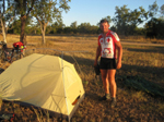
Break on the road.
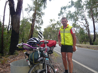
Day 19 I was now facing the
Australian "Alps". The next 3 days would be the hilliest on the
entire trip, and I knew I was bound to lose km here. This day also brought an
unexpected reunion. A
Japanese I had met 2 years ago in Western Australia had followed my
progress on the net and waited for me about 60 km before Eden. It was a nice gesture,
and he wrote a "statement" in my book. He also carried a bag with
various fruit and other food which I ate later in the tent. Camped
in the forest about 35 km before Eden.
247.38 km and 2735 high & low. Pos. 37.285500 S 149.780008 E
Day 20 This day was the
journeys most hilly, and I felt it as if the Australians
had spent the last few years to heap even more hills up. Just north of Eden was
the steepest hill where I last time, with the trailer, had been forced to get
off the bike and pull a few hundred meters. This time, I had less
luggages, but still I had to walk a little bit. The journey’s first puncture, appeared
50 km before Batemands Bay, the days goal, where
I checked in for the night at a caravan park. Traffic is close here, and with
many trucks on the not always good roads, the nerves get a bit jagged.
233.55 km and 3475 high & low. Pos. 35.702780 S 150.181549 E
Day 21 Started at 2 am. I
wanted to reach Sydney early and I still had a lot of hills to climb. When I
came to Wollongong, about 85 km south of Sydney, I phoned my good
friend Lars Bording in Sydney, and we agreed to meet
in the town Waterfall about 45 km south of Sydney. Before the start of the
journey I had sent new tires and other gear down to him, Stuff
that I might need. About a third of the trip was now completed.
Earlier this day I had also called Eugen Schilter and told him where I was. I knew he was interested
in us meeting. Great was my surprise when he suddenly came cycling,
approximately. 70 km before Sydney. We followed the road
towards Sydney. After we had forced a steep hill, and had the prospect of a
more or less long downhill for the rest of the way to Sydney (50-60 km) we had
a break, and Eugen was host to a big apple pie, which
we ate.
It had looked like rain for a long time, and now it began to pore down. Since
there were no shelter, we continued towards Waterfall
in the rain. It was only a shower and when we arrived at Waterfall, it had
almost stopped. We found Lars Bording waiting with my
gear. I immediately switched to new tires on the bike and also put new pedals on,
for safety's sake. Lars had his bike with him and would lead me through
Sydney. The plan was, even though there was only 2-3 hours of daylight left, to
cycle through Sydney and find accommodation in the northern outskirts of the
city.
Underway, we were greeted
several times with heavy showers. It turned out to be some of the more exciting/dangerous
hours on the journey, not least because it was dark, and the traffic heavy. I
remember in particular a tunnel under the airport with heavy traffic in both directions, no shoulder and a stench of airplane fuel
from starting planes as particular exciting. In the evening, we biked over Harbor
Bridge and I found a motel for the night a few km later. Lars' wife Lisa came to pick up Lars
and carried a pot of spaghetti and meat, which was quite wonderful, as I
hadn’t had sufficient food since Denmark.
283.87 km and 3010 high & low. Pos. 33.822707 S 151.186325 E
Day 22 I started out late at 4 am in
a quiet rain. Soon, I was on the freeway and as the last time it was legal to
cycle there. This time however, after about 10 km it became suddenly banned and I
was forced to use the old pacific highway, which is much more hilly and twisted than
the freeway. After about 50 km, it became legal to use the freeway again, and
the rain had stopped, so I made a good pace. Later during the day it began to rain
again, this time in fierce showers and I prepared myself to find accommodation,
rather than to put up a tent in this weather and sleep in wet clothes.
I had a puncture but found
nothing suspicious in the tire, so I put a new tube in, and continued.
At evening time, I came to a small town where I had expected to stay overnight,
but it was not possible, there was no acommodation. I then continued 20 km forward to the next small town
where there should be more opportunities, while darkness fell. I spent probably a
half hour looking around the town for an overnight stay there, but all were full. It was now
poring down again and when I left the last option for accommodation,
a caravan park, I prepared myself to continue about 30 km further to Taree, a fairly large city where there should be good
accommodation options.
It was now quite dark and I missed to notice a high
edge on the pavement when I rolled out on the main road, which resulted in me
tipping over, and scratched a hole in my knuckle and one knee. Fortunately, the bike
was unharmed and I could continue, while feeling quit sorry for myself. The day
had been long and I was freezing, it was pit dark and poring down, and with the
blood dripping from my wounds, it could not be much worse I thought. I had to
revise the view a few km later as there were roadwork’s again, but fortunately not
with gravel road.
I arrived in Taree
and was lucky already at the outskirts of the city to find a Caravan park with
a Cabin vacant, and furthermore, there was a service station right next to, so
I could get supplies while my clothes dried in a dryer. After a half hour when
I felt warm again, I could at least feel happy that the troubles had brought me
longer than planned, despite the late start in the morning.
305.15 km and 1100 high & low. Pos. 31.937213 S 152.467754 E
Day 23 Very heavy showers characterized
this whole day and I was soaking wet from the beginning. This resulted also in the
journeys second saddle wound, but this time not as bad, as it only entertained me
a few days with pain in that part of the body. Traffic, rain and bad shoulders made
this day a strucle, and for once I stopped early , to find
shelter, get in dry clothes, and have a good long sleep.
I found a motel room in
Coffs Harbor, bought food and prepared myself for sleeping. The rain outside
was extremely violent and suddenly I discovered that water splashed in through
the air conditioner, which hang on the wall, and down on my clothes which was supposed
to be drying. I rushed to the reception, as I predicted it could lead to a short
circuit, meaning I would not have heat in the room. The owner had only a shrug
of the shoulders about it, that was what happened when it rained so heavily, he
said. That the carpet also got soaked didn’t seem to worry him at all.
229.03 km and 1156 high & low. Pos. 30.308118 S 153.099950 E
Day 24 It was dry when I
started out in the night, and traffic weak, so
everything was a little easier. The middle of the day I had a puncture again,
and I found it very surprising that I now have had 2 puncture on a bran new tire. I had
a suspicion that the foreign matter that had caused the first blow, perhaps
still was in the tire. This time I did what I should have done the first time,
pump air into the tube, locate the hole, and lay the tube on the tire
to find the spot where the problem was. I still found nothing, so I patched the
tube and arranged to mount it as it had sat when punctured. Then the patch
would, if there still were a foreign body in the tire, act as reinforcement.
Not long thereafter, there was suddenly a long line of cars on my side of the
road, and in the distance I could see there was an overturned truck across the
road. I sneaky went past the row of cars that had the prospect of an hour long
waiting, and were allowed to pass going into a field. Sometimes it is an
advantage to be on a bicycle!
304.72 km and 1549 high & low. Pos. 28.176030 S 153.540890 E
Day 25 This day I passed
Brisbane and therefore, had a lot of city driving and heavy traffic. This was
the last big city to pass, but again I had plotted the route through the city
into my GPS bike computer at home, so it was easy to find my way. The weather
was good and also quite hot now. I visited a pharmacy and bought a tube of
grease for my sun burnt ears, It didn’t help much
though. In the outskirts of the city, I pulled in to a bike shop and had my
left detailer adjusted, as it was not working properly. The owner was also kind
enough to write a "statement" – all of it for free.
North of Brisbane, I was not allowed to cycle on the Freeway, but I had taken
account of this at home, and had found alternative ways. After about 50 km, it became
legal to cycle on the freeway again, and there was blowing a good tail wind, so I made
a good pace the rest of the day.
280.44 km and 1650 high & low. Pos. 26.186150 S 152.652650 E
Day 26 I had incurred myself
a few defects on my way. The knees were however, much better, I had only ease
pain in the left knee in the first few hours each day.
My saddle sore was also
almost gone now, but a new disorder that had developed in a negative direction lately,
was my hands which now slept in their tips on the left hand while the right
hand was partially paralyzed. I had difficulties using my thumb because it was powerless.
The reason for this defect was probably the constant pressure on nerves from
the handle bars and up to the carpus.
It is quite astonishing how much one uses the thumb without thinking about it,
and one of the things I had to give up was to write cue down to this diary. I
was not able to hold the pen, so the rest of the trip will be
described solely by memory, and will therefore probably not be very comprehensive.
From day 26, I remember only
that I had yet another puncture, and this time I found a small hole in the
patch I had put on. A very small needle like piece of wire stuck forward now, so
I could see it because it this time had to go through both the patch and the tube.
I removed the wire which had been the cause of 3 puncture and had no more
puncture for the rest of the trip.
274.18 km and 1771 high & low. Pos, 24.504280 S 151.613864 E
Day 27 This day I do not have
any specific memory of, but I have probably cycled up along the east coast.
274.33 km and 1087 high & low. Pos. 22.883456 S 150.069420 E
Day 28 Remember it as a long
day which brought me a little north of Mackay, where I had forced the pace, to
arrive at a Caravanpark after having slept the last
few nights in the tent. The sun was almost gone when I came to a Pub in the
countryside, where there were some caravans. People were having a good time in
the pub with loose women inside and out. Not a place I would normally go into,
but it was late and the countryside was agricultural land, with limited ability
to camp. I went into the bar and enquired on the night and was referred to a very
drunken man who apparently was the “head” here. When he heard I was on a record
trip, he thought that was quite cool and said I could sleep there for free.
There were 4 motel rooms and I could choose the one I’d like, he said while he laughed.
I soon found out why, as the
best room had only a filty mattress on the floor, and
a few just as dirty furniture. The whole room was no less dirty, but ok I
thought, it was free and I was tired and had no other options. I turned the madrassen up to knock the worst of the dirt off, which
disturbed a giant spider, which I unsuccessfully tried to kill. Well, it was
probably not toxic anyway, I thought, and would have stayed if not in the other
corner, now jumped a frog out. This, combined with a noisy
Pup 10 meters away, made me decide that I had enough and went back into the pub again, as
I assumed he just had a little mockery of me and had better accommodation
elsewhere. He had not, and he could not understand why I was not happy with the
room. I told him I wasn’t keen on the spiders and frogs in the room. “Don’t be
such a sissy, you are from Denmark, you’re the
Vikings” he said.
Vikings ore not, I decided to continue
cycling, hoping to find a place to put up the tent in the dark.
Approximately 5 km later appeared, nevertheless, a real caravan park, which was
operated by an elderly couple. The place was in direct contrast to the pub, everything
here was all clinically clean and with lace at the bedding. The couple even gave
me free food for the day after, when they heard I supported the Red Cross.
289.52 km and 812 high & low. Pos. 21.006265 S 148.874780 E
Day 29 The day brought more
spiders. I had to pass a bridge which was around 750 metres
in length, and led over a river, just after Home Hill. And because it was
long and narrow with large trucks, I decided to use the footbridge that hung
just below the bridge. There were apparently not others who used the
footbridge, I discovered. The bridge was overwrought with spider web, which sticky
settled on me and my bike. Suddenly there was a couple of giant spiders sitting
on the bike only 10 centimeters from my left hand, and I quickly stopped, and drove
the spiders away. The last part of the brigde,
I had to walk, so I could chase spiders away in time.
Later I arrived at Ayer, a fairly
large town with a tourist office, I enquired on the possibility of accommodation
about 50-60 km further on. The staff was 3 elderly ladies who were
quite interested to hear all about the Danish crown prince couple. I'm sure
their knowledge on this matter was larger than mine, so I was not able to help
much. They were concerned about Frederik being nice
to their Mary!
They weren’t to much help on
the enquiring, their knowledge area only covered
the city, so I then continued towards Townsville, after topping up on food. I put up the tent by the roadside
about 30 km south of Townsville.
311.67 km and 723 high & low. Pos. 19.454518 S 147.044100 E
Day 30 Bought supplies in the night silent city of Townsville and otherwise had a
quiet day at the office, although very busy traffic. In the town of Cardwell, I
had hoped to buy an apple-pie at the local bakery, but unfortunately it was
closed, so again I ate fast-food at a service station. Found accommodation at a caravan
park approximately 4 km south of Innesfail.
298.24 km and 498 high & low. Pos. 17.557389 S 146.035384 E
Day 31 When I cycled through Innesfail I had to decide
whether I would continue to Cairns or take the Palmerston
highway west. Although the route to Cairns would be more accurate, it was not a
requirement, since the former record holder had not cycled there either. I had chosen
in all a 359 km longer route down south, and decided that it was enough.
Furthermore, I was fed up with the east coast’s traffic, and only wanted to go
west as soon as possible, where traffic is much less.
Palmerstone Highway brought me over the Great Dividing
Range, and at one point I was 1104 meters above sea level. I arrived at Mount Surprise
at the end of the day where I found accommodation in a caravan park.
260.21 km and 1912 high & low. Pos. 18.143203 S 144.321300 E
Day 32 When I left the caravan park, I saw large fruit bats flying around
between the treetops, good thing they are not man-eaters! The night reviled in addition
to the usual experience with kangaroos and wild cows, also dingoes and rabbits.
Arrived at Georgetown early morning and bought supplies for my further progress
at a gas station with associated general store. I ate some oatmeal on a bench
outside, and suddenly the lady in the store came out to me and gave me a bar of
chocolate for free, nice!
I continued on to Croyden where I arrived at the beginning
of the afternoon. Here I would have to buy supplies for the next 1 ½ days, because
I had decided to test whether it was possible to have water and food for so long a
period on the bicycle. It might be useful to know, and crucial if I later on
should chose between the 377 km long route to Cape Crawford, or the 96 km shorter route over Three ways as the rules stated.
The day was one of the hottest with 36 degrees in the
shade, so it corrode well on the water stock. Suddenly
I heard the characteristic sound “DOC“ from the front
wheel, which meant that a spoke had broken. It´s the first time ever, I experienced a broken spoke on my front wheel! it´s usually always the rear wheel that breaks spokes. It
appeared that the spoke had broken near, and not in the elbow, and it could
indicate that there had been a weaknes in the metal.
Earlier this day I had talked to a Road train driver
who reported a cyclist in front of me. This cyclist would stay for the night about 65 km
west of Croyden at something called the Black Bull
Siding, no more than a rest area. My interest grew bigger when I became aware
that it was David in OZ, an English
cyclist, I had followed on the Web before I even came here.
I decided to
try to reach Black Bull Sidding so that I could meet him. I arrived as the sun was about to go
down and rolled up to his tent and said much to his surprise, Hi David.
It appeared he had also been on my website and look before he went to
Australia, so we knew a little about each other in advance.
David in OZ, with his "Statement"
I needed of course my value of sleep so it was not so much talking and I camped
a bit away from David, so I would not wake him when I packed together in the
middle of the night. David came over with a bag containing an orange and other
thing for me and I got him to write a "statement".
301.89 km and 1150 high & low. Pos. 17.941020 S 141.755200 E
Day 33 I was a little worried when I left, as the day and the night before had
called for plenty of fluids. I was not sure I had enough for the whole day, and
maybe I would have to create a detour of 2x7 km to Normanton
about 85 km ahead. This night a wild boar family nosed around on the shoulder.
Later in the night, I heard screams that sounded like wild boars fighting violently ahead of
me. It had however stopped before I came to the scene where the smell of pigs still
hung in the air.
I arrived at the junction before dawn and I had to
decide whether the 2.4 litres of water I had left
could last the next 180 km south to Burke & Wills roadhouse, or whether I
should take the 2x7 km extra north to Normanton and top
up on water there. It was still cold and I was not really thirsty, and also feared
I would have to wait until they opened the shops, so I decided to go south and
hope I could stretch the water to last all the way.
It was obviously not very wise in hindsight, because
when the sun got up and started to burn down on me, it increased my need for
liquid dramatically. I Started rationed the water and only alowed myself a bit of water every 20 km. I kept on till about 60 km before Burke & Wills, by
then I had long been out of water and so dehydrated that I was aware I had to beg water from some campers
if I were to avoid kollaps. Fortunately, I found a family at a rest area which gave
me all the water I could drink + a little for the rest of the trip to Burke
& Wills.
277.76 km and 189 high & low. Pos. 19.226750 S 140.347600 E
Day 34 Left Burke & Wills and had an uneventful night and morning to Cloncurry, where I topped up on supplies in order to reach
Mount Isa for the night. I have had a little laborious headwind to Cloncurry, but now the road turned west, and I would have
a half tail/cross wind the rest of the day, so it would probably be easy riding.
The wind didn’t help much, because it’s quite hilly on
this route, and the heat was unbearably, up to 34 degrees. I was, nonetheless, at
Mount Isa before the sun went down and got a cabin at a caravan park in the
western outskirts of the city.
307.01 km and 873 high & low. Pos. 20.707900 S 139.494342 E
Day 35 I left the caravan park early in the night and bought supplies at a
service station that had open 24 hours. There was a bunch of drunken aborigines’
at the store, but they didn’t bother me, and I continued my process into the
night. The city Camooweall was reached, where I filled up with liquid and food for the next 24 hours.
Shell roadhouse at Camooweall.
The day was hot and about 70 km west of Camooweall was a rest area with a water
tank, where I had hoped to be able to fill up my water bottles. A sign on the
tank warned me that it was not sure the water was fit to drink, so I continued
until the next tank, approximately 65 km further on. Arrived at sunset, but
here was the same message. I decided to take the chance and filled the bottles
with 75% water and 25% cola. I then hoped that the cola would kill any bacteria.
I am otherwise very against camping at these service areas since there
is always noise from other campers, children, dogs or some generator going. I needed
to fall asleep at 18-19 pm, as I get up at 1 am in the night. However, I was
alone and decided to put the tent up here anyway.
Before I fell asleep of course, a camper came in with
2 children and 2 dogs, and they of course made a lot of noise!
325.32 km and 330 high & low. Pos, 20.073257 S 136.878200 E
Day 36 The next day, my stomach was a little upset, and I promised myself, I
would never drink water from these tanks again! It´s much better to beg a little water
from campers if needed. Bought supplies at Barkly roadhouse for the rest of the day, I hoped
to reach Three ways before evening. It is here at
Barkly roadhouse the road to Cape Crawford begins, but before the trip started I had promised
myself that I would only go up there if I had good tail wind from the south. I did
not, the wind was heading west and so did I! Reached Tree ways as planned, and
got a little laundry done.
312.76 km and 256 high & low. Pos. 19.436999 S 134.208690 E
Day 37 I don’t remember much about the day, other than I had a good half tail
wind and I hastened the pace to reach Dunmarra
roadhouse. I succeeded as the sun went down. The Roadhouse looked dark and
closed off, so I asked an aboriginal who sat and hung on the veranda if it was
closed. "I do not know, it is not me who owns the
roadhouse" he answered acidic. Well, I went to the door and unexpected, it
was open. Inside, was quite dark, but it was open and luckely I got both accommodation
and food.
329.26 km and 606 high & low. Pos. 16.679710 S 133.413065 E
Day 38 Again an early start. I would try to reach Katherine to get the distances to
suit for the next several days. I do not remember there was anything special that
day, only that it was very hot and that I was glad to be able to buy cool
liquid 2 times on the way. I found accommodation on the outskirts of Katherine
on the way out of town, on Victoria highway. It was in a caravan park only approximately
20 meters from a gas station where they sold fast-food, who can then ask for
more?
320.47 km and 359 high & low. Pos. 14.485108 S 132.256829 E
Day 39 Many small kangaroos to start with, and in many places also fire in the bush. It
looked absolutely fantastic in the dark. Some of the trees were full of embers
and lit like Christmas trees. The fires has problely been started deliberately along
the road in this season, where it does not get out of hand.
The landscape and the nature here is beautiful, with
many red rocks which have a very special light in the sunrise. If I were to
pick a particularly beautiful area in Australia, it must be the route from
Katherine to Broome, due to the beautiful nature and wildlife. I got an early noon
stop at Victoria river roadhouse and ordered toast, eggs and sausages.
Timber Creek 90 km further on was achieved, and here I
bought food and water in large quantities because I would not have any opportunity the next 24
hours. Continued then until the sun went down, and found a place in the bush and
put up the tent.
322.47 km and 869 high & low. Pos. 15.685721 S 130.167318 E
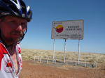
Day 40 A rather cold night
/ morning. I remember it as a very flat area to start with. I arrived at the
border to Western Australia at 9.30 am Northern territory time, but 8 am in
WA time, as time changed 1 ½ hours here. I got a border guard to write a
"statement" in my book, and I was allowed to come into the office and
get washed. I was quite dirty after 3 days without a bath, and I would like to
be a little more presentable when I 42 km later would arrive to the town of
Kununurra.
Here was my second depot on the trip, with fresh tires
and tubes. The manager of the BP station in Kununurra, Lynne Kenworthy
had kindly allowed me to send my gear down to her, which was quit good because they had 24 hour service! This way, I could be
provided with my gear at any time of the day, I might pass by. I had advised
Lynne a day in advance, so I was expected when I came to Kununurra in the middle
of the day. I changed tires and got a new bike jersey and other gear I had sent
there. The local press was also present. Lynne insisted that I should eat and fill
up my supplies for free at the store, Thanks Lynne!
I then continued to Doon Doon roadhouse, approximately 100 km past Kununurra. They had no accommodation, but I could put up
the tent in the camping area for $ 10, and
I could also get a much needed bath. I was the only
one there at first, but unfortunately there soon came more visitors, and peace was destroyed,
so I did not get any sleep the first few hours.
292.72 km and 509 high & low. Pos. 16.308641 S 128.247399 E
Day 41 When I left the camp the entrance was closed by a fence. I peeled it down,
and walked in the gravel to reach the main road. Suddenly there was a rumbling
in the bushes next to me and a herd of cows took the flight, away from me and
over the road. It was
probably the reason for the camp being fenced at night. I arrived at Turkey
Creek 7 am in the morning, after about 100 km, and had a solid breakfast.
Then I continued towards Halls Creek.
At one point I suddenly felt a huge tail wind and dust and grass whirled past
me and I had trouble controlling the bike. A split second later, I was aware that
I had been hit by a wind spout from behind, and stopped immediately to prevent falling.
Before I managed to stop completely, however, it was all over, I was fortunately only
been slightly hit by it. I have seen a lot of these small wind spouts. They
occur suddenly and disappear just as suddenly.
In Halls Creek,
I bought large quantities of food and water because I again had a day’s ride
ahead of me before the next opportunity.
Bush camping.
I continued towards Fitzroys Crossing, 292 km away until
sundown 2-3 hours later, and camped in bush.
290.72 km and 755 high & low. Pos. 18.456100 S 127.419253 E
Day 42 I don’t remember so much about this day, other than I got supplies in Fitzroys Crossing and then continued towards Willarre Roadhouse and the sunset. Set camp in a drain
ditch, because it didn’t look like rain J
317.30 km and 448 high & low.
Pos. 17.967899 S 125.037133 E
Day 43 Again, there’s is not much I remember from this part, except of cattle on
the roads, and that Willarre Roadhouse had changed
the store. Now there was a small niche with pastries and I had me a long missed
Apple-pie. I arrived at Roebuck Roadhouse at the end of the day and bought
supplies for the next day’s 286 km to Sandfire Roadhouse, situated halfway across the Great Sandy Dessert.
296.27 km and 292 high & low. Pos. 17.847656 S 122.500718 E
Day 44 After a long day, I arrived to Sandfire Roadhouse
which had burned down about 1 year ago and still had not been rebuilt. Business
was operated from a small shed and food was limited to sweets and sandwiches. At
the shed was a very depressed young girl. She was stranded with 3 other 10 km
north of Sandfire, because their car had broken down. She had phoned after
assistance in Broome, 319 km away. It would take the mechanic 3 hours to
arrive.
I could not
help thinking what it perhaps would cost them, a burden they probably could not
afford.
Checked in at a motel room for the night.
286.43 km and 262 high & low. Pos. 19.769018 S 121.091750 E
Day 45 Arrived early morning to Pardoo Roadhouse, 140
km southwest of Sandfire, where I had great breakfast with toast, eggs and
sausages. I continued then to South Hedland and had actually decided to stop
there for the night, a little early, so I could get my clothes washed + some
other chores. Unfortunately, the caravan park I stayed at 6 years ago was in
the meantime transformed into housing, so if I would have accommodation I had
to pedal a couple of kilometers back, and that was not an option. I never go back on my trips! I therefore
decided that it was not this day I should have my clothes washed, and bought
supplies for another night in the bush.
After a few km and some road work, I had the bike up in
speed and continued almost another 50 km to a rest area, where it was allowed to
stay overnight. I was about to put the tent up when suddenly someone shouted
"Hello, Erik." It proved to be a motorcyclist I had exchanged a few
words with a few days earlier. He asked to my hands and offered to massage them
for me, because it was something he was capable at. I got the big massage, and
it was as if they slept less afterwards, but several days after it was more
painful in the hands than before he had massaged them.
A couple gave me a bottle of frozen water so I still would
have cool water the day after, beautiful!
Very little sleep again because of noisy neighbors.
336.76 km and 265 high & low. Pos. 20.699550 S 118.299300 E
Day 46 Some cows roared by 11 pm, and I got up and was
on the move again at midnight as I had done it the last few days because of the
heat. First, however, the cows had to be scared away. There were also a few out on a
long bridge that went over the river.
I remember a mysterious car in the night that passed
me a few times at slow speed. Later he came back and drowe
a little next to me, the window rolled down, and he asked if I had seen a
motorcycle get past. I had not, in fact, he was the
only one I had met so far this night. The man then disappeared ahead, and I saw
no more of him. Mysterious why he was sneaking around at 2 am in the morning!
I arrived in the town of Roebourne
a-half an hour before the supermarket opened, and I had to wait. It was
important for me to buy lots of oatmeal here. The ability to buy adequate food
would not be present the next 3 days. I bought 3 packages and put them on the
side of the bike basket in the straps I had mounted for the same reason. The
day ended up very hot and a couple of times I had to seek shelter under a
bridge to cool down a bit. In the middle of the day, I was lucky to get some ice-cold
water of some road workers.
I arrived a little early to Fortesque
Roadhouse and finally got my clothes washed. I had a room at half price
because it was not cleaned after the last guest. There was a second biker
there. He was somewhat concerned about how little the selection was in the
shop. He drove around 100 km per day, and had 165 km to Nanutarra
roadhouse with also little selection, and then the 227 km to Minilya
roadhouse which was very sparingly with the selection. He was right to be
concerned!
I bought a package of frozen bread and gave him half,
I didn’t have room for it all anyway. I had a little jam, for the bread, but
unfortunately only enough for myself. They had no milk for my cereal, so fast-food
again.
277.77 km and 256 high & low. Pos. 21.295042 S 116.137850 E
Day 47 Left Fortesque at midnight, and had a long day
of dessert like terrain, with a slightly laborious headwind. Ate late breakfast
at Nanutarra roadhouse, and continued until sunset,
where I camped in the bush.
A bird sang an incredibly beautiful serenade before I
closed my eyes, I remember.
293.95 km and 310 high & low. Pos. 23.141284 S 114.517409 E
Day 48, I came to Minilya roadhouse ½ an hour before
they opened. The morning was cold, so I walked a little around in order not to
freeze. This day, I was for one reason or another, more tired than usual, I had
also run out of food, so when they opened, I ordered double portion of toast,
eggs and sausages. Here the units were very small though, so I had to buy some muffins
as well to make the hunger less present. I bought supplies for the 141 km to Carnarvon,
and continued on.
The headwind was strong, and because the terrain was
wide open, there was no shelter to get. Approximately 10 km before Carnarvon
the desert stops and suddenly there was lush fields of
various fruits along a big river. On signs, I learned that it was a test area. My
knees began to complain again because of the flat land, headwind and
therefore constant pressure.
I concluded that
the last 900 km to Perth could not be achieved in 3 days anyway, since I could expect
headwind and hills rest of the way. I might just as well take a short day, and
stop at Carnarvon, and thereby spare my knees a little. The temperature that
day went only up to 25 degrees, so I was now in cooler areas.
231.03 km and 204 high & low. Pos. 24.863192 S 113.703045 E
Day 49 It still blew a strong headwind and the ground was quite flat and
completely open, so I was slowly progressing. I tried not to overload my knees,
and they luckely didn’t get worse this day. Stayed at Billabong
roadhouse for the night.
242.20 km and 275 high & low. Pos. 26.816269 S 114.613984 E
Day 50 The terrain became hillier and I didn’t have so much trouble with the
knees this day. Although the wind hadn’t gone weaker, I now made a higher
speed, as there was more shelter from the wind in this area. I passed Geralton in the beginning of the afternoon, a large city,
but I had no business there, so I bought supplies and then continued to Dongara where I found accommodation.
296.18 km and 1266 high & low. Pos. 29.246998 S 114.932605 E
Day 51 Now only approximately 365 km to Perth centre remained, so this would be
the last long days on the trip. I had advised Australian Red Cross that I would
be by Swann Bell tower before 8 am, the day after. The first 100 km was still head
/ cross wind, but then I had a half tail wind, so I made a good pace. Had
planned to stop at GinGin, and then take the last. 80 km at night. I would then have time to arrive at the Bell
tower before 8 am tomorrow. Unfortunately, GinGin was
not situated at the main road and I'm not biking off the route unless it
absolutely
necessary.
It wasn’t late because of the tailwind, so I decided
to continue towards Perth and check in at the first the best accommodation offered.
It turned out I ended up only 22 km from the target in Perth, in the town of
Midland, before I found accommodation. I could easily have continued into the
Swann Bell Tower, but I had an agreement with the Red Cross, and I knew it
meant a lot for them to gain publicity for the trip in the media, so I decided
to stay in Midland, and then take it very easy the next morning.
341.66 km and 1106 high & low. Pos. 31.876542 S 116.011741 E
Day 52 The last 14 days I have had the habit of starting out at midnight, so it
was quite a luxury to sleep until 3.30 knowing that I only had to cycle around
22 km before 8 am the next morning. I took my time this morning and rolled out
in the dark at 5 am. Still far too early, but then I had plenty of time if I
had to deflate, or have other problems here at the last minute. I was down at
the Swan River just past 6 am and could see the tower only approximately 1 km
away. Now I had to wait to about 7.45 am, where we had agreed I would arrive.
It was cold in
the early morning air and I was pleased when it finally was time to trundle
over the finishing line.
Pos. 31.958801 S 115.857580 E
Finish!
There was a nice bunch of Red Cross people, Danish /
Australians, and media people waiting for me, and the Red Cross staff had made a
"finish" banner, which I had to bike through.
The trip was
officially over and I was happy and proud to have set a new record by biking
the 14.611 km around Australia in 51 days and 47 minutes.
The record has subsequently been approved and the 15.000 $ payed to Red Cross.
|